
【iPhone話題アプリ】OpenMaps PROdigital topographic mapsの評価・評判、口コミ
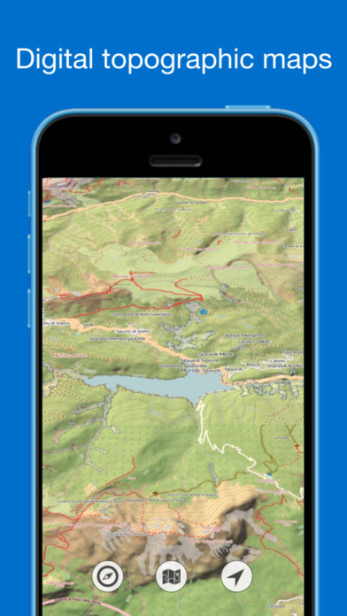

The most detailed map is now available for iPhone and iPad.
Why use OpenMaps:
This map references the live tiled map service from the OpenStreetMap (OSM) project.
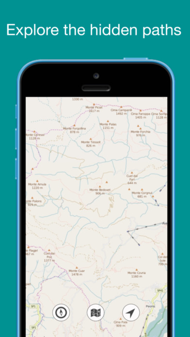
You can find all kinds of roads, mule tracks, dirt roads, country roads ...
Indispensable for trekkers, mountaineers, mountain bikers, or simple enthusiasts of hiking.
What'is OpenStreetMap:
OpenStreetMap (OSM) is an open collaborative project to create a free editable map of the world. Volunteers gather location data using GPS, local knowledge, and other free sources of information and upload it.
The resulting free map can be viewed and downloaded from the OpenStreetMap server: http://www.OpenStreetMap.org. See that website for additional information about OpenStreetMap. It is made available as a basemap for GIS work in ESRI products under a Creative Commons Attribution-ShareAlike license.
With this new version is included today widget with altitude, sunrise sunset calculator and current address.
Why use OpenMaps:
This map references the live tiled map service from the OpenStreetMap (OSM) project.
You can find all kinds of roads, mule tracks, dirt roads, country roads ...
Indispensable for trekkers, mountaineers, mountain bikers, or simple enthusiasts of hiking.
What'is OpenStreetMap:
OpenStreetMap (OSM) is an open collaborative project to create a free editable map of the world. Volunteers gather location data using GPS, local knowledge, and other free sources of information and upload it.
The resulting free map can be viewed and downloaded from the OpenStreetMap server: http://www.OpenStreetMap.org. See that website for additional information about OpenStreetMap. It is made available as a basemap for GIS work in ESRI products under a Creative Commons Attribution-ShareAlike license.
With this new version is included today widget with altitude, sunrise sunset calculator and current address.
ランキングチャート
このアプリは最近ランキングに入っていません
OpenMaps PROdigital topographic mapsのレビューや評価・評判、口コミまとめ
- 話題アプリ認定!
- うーん…。
レビュー募集中!!OpenMaps PROdigital topographic mapsを使って分かったことを書いてみよう!